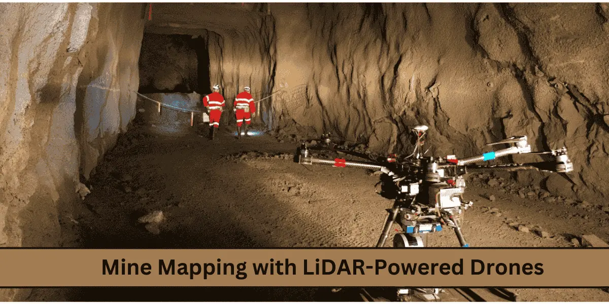
Mining operations require advanced technology to ensure efficiency, safety, and precision in mapping complex terrains. LiDAR-powered drones have revolutionized mine mapping by combining the accuracy of LiDAR with the agility of drones. These drones operate with advanced features such as GPS-independent navigation, real-time terrain following, and AI-powered data analysis, making them indispensable in modern mining.
What is LiDAR Technology?
LiDAR, short for Light Detection and Ranging, is a remote sensing method that uses laser pulses to create detailed 3D maps of an environment. LiDAR-equipped drones are especially effective for mining applications, enabling precise mapping even in challenging or hazardous terrains.
How Does LiDAR Work?
- Laser Pulses: Emit laser beams to measure distances to objects.
- Sensors: Capture the reflected laser beams to calculate distances.
- IMU (Inertial Measurement Unit): Tracks the orientation and movement of the drone.
- GPS (Optional): Provides geolocation data, although not always necessary for mine drones.
Features of LiDAR-Powered Mine Mapping Drones
1. GPS-Independent Navigation
In mining environments where GPS signals are unreliable or non-existent, these drones excel by using advanced onboard sensors for navigation.
2. Semi-Autonomous Operation
LiDAR-powered drones can navigate confined spaces and autonomously return to their starting point, minimizing the need for manual control.
3. Photogrammetric Cameras
While LiDAR is the primary tool, many drones include photogrammetric cameras for capturing high-resolution images to complement LiDAR data.
4. Real-Time Terrain Following
Drones equipped with terrain-following capabilities can maintain a consistent height above uneven ground, ensuring precise data collection.
5. Artificial Intelligence
AI algorithms enable these drones to analyze large datasets efficiently, identify hazards, and provide actionable insights.
Applications of LiDAR-Powered Drones in Mining
1. Topographic Surveys
LiDAR-equipped drones create highly accurate 3D maps of mining sites, including underground and surface environments.
2. Stockpile Volume Measurement
These drones measure stockpile volumes with exceptional precision, reducing errors in inventory management.
3. Slope Stability Monitoring
Real-time data from LiDAR drones helps monitor slopes, identify potential risks, and prevent accidents.
4. Subsurface Mapping
LiDAR can penetrate through vegetation and uncover geological features that are critical for planning and exploration.
5. Hazard Identification
AI-powered drones analyze collected data to identify unstable areas, cracks, or other safety hazards in mining environments.
6. Infrastructure Planning
Detailed maps generated by these drones aid in the design of roads, drainage systems, and other essential infrastructure.
How LiDAR-Powered Drones Work in Mine Mapping
Step 1: Pre-Flight Setup
- Define the survey area with GIS tools.
- Configure drone settings for terrain and resolution requirements.
Step 2: Autonomous Flight
- Drones execute pre-defined flight paths, capturing data with precision.
- Features like GPS-independent navigation and real-time terrain following ensure comprehensive coverage.
Step 3: Data Collection
- LiDAR sensors generate 3D point clouds.
- Photogrammetric cameras collect high-resolution images.
- AI algorithms analyze the data in real-time.
Step 4: Post-Processing
- Software integrates LiDAR and photogrammetry data to create detailed 3D models and actionable insights.
Benefits of Using LiDAR-Powered Drones
1. Unmatched Precision
LiDAR systems deliver centimeter-level accuracy, ensuring reliable data for decision-making.
2. Faster Surveys
Semi-autonomous drones can survey large areas in a fraction of the time compared to traditional methods.
3. Improved Safety
By eliminating the need for human presence in hazardous zones, drones reduce the risk of workplace accidents.
4. Versatility
Their ability to operate without GPS and adapt to varying terrains makes them suitable for both surface and underground mining.
5. Cost Efficiency
Automating data collection and analysis significantly reduces operational costs.
Challenges in Using LiDAR-Powered Drones
1. High Initial Costs
The cost of LiDAR-equipped drones and related software can be a significant barrier.
2. Need for Technical Expertise
Operating and maintaining these drones require specialized training and skills.
3. Environmental Factors
Harsh weather conditions, such as rain and dust, may impact the performance of LiDAR systems.
4. Battery Limitations
Limited battery life can restrict the operational range, requiring careful mission planning.
Success Stories of LiDAR-Powered Drones
1. Australian Open-Pit Mines
Mining companies in Australia have reduced survey times by 70% using LiDAR drones while improving data accuracy and safety.
2. Underground Mining in Canada
LiDAR drones have successfully navigated and mapped underground tunnels, providing critical data for safety and planning.
3. Stockpile Management in South Africa
South African mines have used drones to achieve highly accurate stockpile measurements, saving millions in operational costs.
Future of LiDAR Drones in Mine Mapping
1. Enhanced AI Capabilities
AI integration will enable predictive analytics, improving safety and efficiency in mining operations.
2. Improved Autonomy
The development of fully autonomous drones will reduce the need for human intervention even further.
3. Longer Battery Life
Advancements in battery technology will allow for extended flight durations and broader coverage.
4. IoT Integration
Connecting drones to IoT networks will enable real-time data sharing and streamlined decision-making.
Conclusion
LiDAR-powered drones are transforming the mining industry with features like GPS-independent navigation, real-time terrain adaptation, and AI-driven analysis. Their ability to produce accurate maps and identify hazards makes them indispensable for mining companies looking to enhance safety, efficiency, and cost-effectiveness.
Take your mining operations to the next level! Contact inphoenixaviation.com for customized drone solutions tailored to your needs.

